Category:Cockfield, Suffolk
Jump to navigation
Jump to search
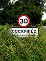
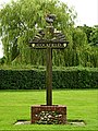
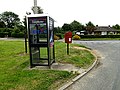
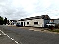
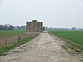
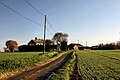
English: Cockfield is a village and civil parish located approximately 3½ miles from Lavenham in Suffolk, England. The village consists of a central point and several outlying hamlets: Buttons Green, Colchester Green, Cross Green, Great Green, Oldhall Green, Smithwood Green and Windsor Green. Surrounded mostly by fields used for farming, and with few roads, its population was 839 in 2001.
village in Suffolk, England, United Kingdom  | |||||
| Upload media | |||||
| Instance of | |||||
|---|---|---|---|---|---|
| Location | Babergh, Suffolk, East of England, England | ||||
 | |||||
Subcategories
This category has the following 12 subcategories, out of 12 total.
B
- Bull's Wood (9 F)
- Button's Green (2 F)
C
- Church House, Cockfield (2 F)
- Cockfield railway station (7 F)
- Cross Green, Cockfield (7 F)
G
H
O
- Oldhall Green (1 F)
P
S
- Smithwood Green (1 F)
W
- Windsor Green (1 F)
Media in category "Cockfield, Suffolk"
The following 146 files are in this category, out of 146 total.
-
 A Remaining Pole - geograph.org.uk - 2316083.jpg 1,200 × 1,600; 722 KB
-
 A Small Part - geograph.org.uk - 2316137.jpg 1,600 × 1,200; 363 KB
-
 A1141 at the junction with Howe Lane - geograph.org.uk - 4032327.jpg 3,072 × 2,304; 1.5 MB
-
 A1141, Cross Green, Cockfield - geograph.org.uk - 4196396.jpg 640 × 480; 156 KB
-
 A134 at the junction with Windsor Green - geograph.org.uk - 4032459.jpg 3,072 × 2,304; 755 KB
-
 A134 at the junction with Windsor Green - geograph.org.uk - 4032461.jpg 2,558 × 1,793; 625 KB
-

-
 A134 towards Bury St Edmunds - geograph.org.uk - 5400544.jpg 640 × 480; 72 KB
-
 After The Event - geograph.org.uk - 2619661.jpg 1,024 × 768; 280 KB
-
 Approaching Cockfield by road - geograph.org.uk - 3068410.jpg 2,952 × 1,876; 958 KB
-
 Bale Stack - geograph.org.uk - 2316176.jpg 1,600 × 1,200; 455 KB
-
 Bend in the A134, Star Bridge - geograph.org.uk - 5400523.jpg 640 × 480; 73 KB
-
 Broken Stile - geograph.org.uk - 2823789.jpg 768 × 1,024; 324 KB
-
 Bulls Wood Lane Farm - geograph.org.uk - 2315989.jpg 1,600 × 1,200; 465 KB
-
 Bus Shelter, Seat ^ Roadsigns - geograph.org.uk - 4032313.jpg 3,072 × 2,304; 1.19 MB
-
 Bus Stop - geograph.org.uk - 2316526.jpg 1,600 × 1,200; 501 KB
-
 Cattle Grid Bridge - geograph.org.uk - 2823786.jpg 1,024 × 768; 306 KB
-
 Central AA well of an hexagonal pillbox - geograph.org.uk - 4196512.jpg 640 × 480; 184 KB
-
 Church Farmhouse and St. Peter's church, Cockfield (geograph 6922308).jpg 1,024 × 768; 229 KB
-
 Church Lane ^ Cockfield War Memorial - geograph.org.uk - 4032184.jpg 3,029 × 2,276; 1.66 MB
-
 Church Lane, Cockfield - geograph.org.uk - 4032136.jpg 3,072 × 2,304; 1.03 MB
-
 Cockfield congregational church - geograph.org.uk - 4504820.jpg 1,024 × 768; 511 KB
-
 Cockfield Post Office - geograph.org.uk - 4032050.jpg 3,011 × 2,262; 1.38 MB
-
 Cockfield Post Office ^ Stores sign - geograph.org.uk - 4032094.jpg 2,110 × 2,996; 1.33 MB
-
 Cockfield Village Hall - geograph.org.uk - 4032118.jpg 2,948 × 2,214; 862 KB
-
 Cockfield Village Name sign - geograph.org.uk - 4031694.jpg 2,304 × 3,072; 2.25 MB
-
 Cockfield Village Name sign - geograph.org.uk - 4031695.jpg 2,479 × 897; 570 KB
-
 Cockfield Village sign - geograph.org.uk - 4031978.jpg 2,948 × 2,214; 1.3 MB
-
 Cockfield Village sign - geograph.org.uk - 4032009.jpg 2,279 × 3,042; 1.9 MB
-
 Cockfield Village sign - geograph.org.uk - 4032010.jpg 2,269 × 3,023; 1.4 MB
-
 Cockfield village sign - geograph.org.uk - 4291603.jpg 481 × 640; 201 KB
-
 Country Road - geograph.org.uk - 2783769.jpg 1,024 × 768; 270 KB
-
 Crop field near Windsor Green - geograph.org.uk - 5400527.jpg 640 × 480; 59 KB
-
 Distant View Of Oak Farm - geograph.org.uk - 2316428.jpg 1,600 × 1,200; 435 KB
-
 Disused railway at Earl's Hall - geograph.org.uk - 286596.jpg 640 × 427; 71 KB
-
 Earls Meadow - geograph.org.uk - 2784063.jpg 1,024 × 768; 273 KB
-
 Entering Cockfield on Felsham Road - geograph.org.uk - 4031693.jpg 3,011 × 2,262; 1.59 MB
-
 Felsham Road at the junction with Chapel Road - geograph.org.uk - 3068416.jpg 3,264 × 2,448; 1.76 MB
-
 Felsham Road, Cockfield - geograph.org.uk - 4031696.jpg 3,072 × 2,304; 645 KB
-
 Felsham Road, Cockfield - geograph.org.uk - 4031844.jpg 2,950 × 2,120; 665 KB
-
 Field Boundary And Footpath - geograph.org.uk - 2784467.jpg 1,024 × 768; 200 KB
-
 Footbridge - geograph.org.uk - 2823777.jpg 768 × 1,024; 436 KB
-
 Footpath - geograph.org.uk - 2315999.jpg 1,600 × 1,200; 657 KB
-
 Footpath - geograph.org.uk - 2783995.jpg 1,024 × 768; 230 KB
-
 Footpath And Old Airfield - geograph.org.uk - 2316401.jpg 1,600 × 1,200; 372 KB
-
 Footpath Sign - geograph.org.uk - 2315966.jpg 1,200 × 1,600; 761 KB
-
 Footpath to Cockfield - geograph.org.uk - 199092.jpg 640 × 427; 88 KB
-
 Footpaths - geograph.org.uk - 2316456.jpg 1,600 × 1,200; 617 KB
-
 Former Railway - geograph.org.uk - 2316085.jpg 1,600 × 1,200; 783 KB
-
 Former railway line - geograph.org.uk - 1455908.jpg 427 × 640; 181 KB
-
 Gallow Lane at Smithwood Green - geograph.org.uk - 2272393.jpg 3,648 × 2,736; 1.21 MB
-
 Gallows Lane - geograph.org.uk - 2316098.jpg 1,600 × 1,200; 696 KB
-
 Gate Into Earl's Meadow - geograph.org.uk - 2784055.jpg 1,024 × 768; 342 KB
-
 Gated Entrance - geograph.org.uk - 2315959.jpg 1,600 × 1,200; 847 KB
-
 Grazing near Cross Green - geograph.org.uk - 5400550.jpg 640 × 480; 51 KB
-
 Great Green Postbox - geograph.org.uk - 4031927.jpg 2,241 × 2,992; 2.46 MB
-
 Great Green, Cockfield - geograph.org.uk - 4031853.jpg 3,029 × 2,276; 758 KB
-
 Green Field - geograph.org.uk - 2316002.jpg 1,200 × 1,600; 677 KB
-

-

-

-
-

-

-

-
 Howe Lane, Cockfield - geograph.org.uk - 4032100.jpg 3,072 × 2,304; 1.36 MB
-
 Howe Lane, Cockfield - geograph.org.uk - 4032108.jpg 2,948 × 2,214; 962 KB
-
 Howe Lane, Cockfield - geograph.org.uk - 4032190.jpg 2,888 × 2,169; 913 KB
-
 Howe Lane, Cockfield - geograph.org.uk - 4032208.jpg 2,942 × 2,216; 1.03 MB
-

-
 Kind Farmer - geograph.org.uk - 2315915.jpg 1,200 × 1,600; 292 KB
-
 Log Pile - geograph.org.uk - 2620486.jpg 1,024 × 768; 247 KB
-
 Memorial Seat - geograph.org.uk - 2783783.jpg 1,024 × 768; 322 KB
-
 Minor road towards Windsor Green - geograph.org.uk - 5400534.jpg 640 × 480; 109 KB
-
 Near The Junction - geograph.org.uk - 2619662.jpg 1,024 × 768; 322 KB
-
 New Barn Farm - geograph.org.uk - 2316462.jpg 1,600 × 1,200; 655 KB
-
 Nice Gate - geograph.org.uk - 2315899.jpg 1,600 × 1,200; 621 KB
-
 Old Airfield - geograph.org.uk - 2620502.jpg 1,024 × 768; 209 KB
-
 Old NFS Fire Engine - geograph.org.uk - 2316474.jpg 1,600 × 1,200; 439 KB
-
 Old Telegraph Pole - geograph.org.uk - 2316079.jpg 1,200 × 1,600; 921 KB
-
 Old Trackbed - geograph.org.uk - 2316013.jpg 1,600 × 1,200; 909 KB
-
 Old Trackbed - geograph.org.uk - 2316090.jpg 1,600 × 1,200; 775 KB
-
 Old Trackbed - geograph.org.uk - 2784012.jpg 1,024 × 768; 419 KB
-
 Pavilion on Great Green, Cockfield - geograph.org.uk - 4031859.jpg 3,072 × 2,304; 1.16 MB
-
 Perimeter Track - geograph.org.uk - 2316151.jpg 1,600 × 1,200; 345 KB
-
 Pillbox in Gallows Lane - geograph.org.uk - 4196572.jpg 480 × 640; 115 KB
-
 Pillbox in Gallows Lane - geograph.org.uk - 4196575.jpg 640 × 480; 231 KB
-
 Pillbox in Gallows Lane - geograph.org.uk - 4196584.jpg 640 × 480; 178 KB
-
 Pillbox in Gallows Lane - geograph.org.uk - 4196585.jpg 640 × 480; 112 KB
-
 Pillbox on the railway embankment - geograph.org.uk - 4196600.jpg 640 × 480; 223 KB
-
 Pillbox on the railway embankment - geograph.org.uk - 4196602.jpg 640 × 480; 234 KB
-
 Pink Cottage - geograph.org.uk - 2315874.jpg 1,600 × 1,200; 626 KB
-
 Post Office Howe Lane Postbox - geograph.org.uk - 4032089.jpg 2,304 × 3,072; 2.07 MB
-
 Post Office Howe Lane Postbox - geograph.org.uk - 4032101.jpg 2,304 × 3,072; 1.6 MB
-
 Postbox - geograph.org.uk - 2316556.jpg 1,600 × 1,200; 688 KB
-
 River Brett gauging station - geograph.org.uk - 4196533.jpg 640 × 480; 162 KB
-
 Road bridge over dismantled railway - geograph.org.uk - 1455910.jpg 427 × 640; 128 KB
-
 Road Junction - geograph.org.uk - 2315996.jpg 1,600 × 1,200; 549 KB
-
 Road Junction - geograph.org.uk - 2402879.jpg 1,600 × 1,200; 364 KB
-
 Roadsign on Windsor Green - geograph.org.uk - 4032381.jpg 2,304 × 3,072; 1.17 MB
-
 Roadsigns on the A134 - geograph.org.uk - 4032449.jpg 3,072 × 2,304; 1.73 MB
-
 Route of old railway - geograph.org.uk - 1455903.jpg 427 × 640; 178 KB
-

-
 Shrub Farm sign - geograph.org.uk - 4032440.jpg 3,072 × 2,304; 1.15 MB
-
 Small bridge under dismantled railway - geograph.org.uk - 4196501.jpg 640 × 480; 223 KB
-
 Smile - geograph.org.uk - 2316179.jpg 1,600 × 1,200; 638 KB
-
 Steps Going Down And Up - geograph.org.uk - 2619656.jpg 1,024 × 768; 359 KB
-
 Telephone Box ^ Great Green Postbox - geograph.org.uk - 4031922.jpg 3,072 × 2,304; 1.79 MB
-
 Telephone Box ^ Great Green Postbox - geograph.org.uk - 4031924.jpg 3,072 × 2,304; 1.78 MB
-
 Telephone Box ^ Village Pump on Great Green - geograph.org.uk - 4031883.jpg 3,072 × 2,304; 1.21 MB
-
 Telephone kiosk - geograph.org.uk - 4504774.jpg 1,024 × 768; 425 KB
-
 Telephone kiosk - geograph.org.uk - 4504780.jpg 768 × 1,024; 494 KB
-
 Thatch on the Green, Cockfield - geograph.org.uk - 2482659.jpg 1,024 × 768; 170 KB
-

-
 The bricked-up loophole and gun holdfast - geograph.org.uk - 4196444.jpg 640 × 480; 118 KB
-
-
 The village sign at Cockfield - geograph.org.uk - 2272525.jpg 3,648 × 2,736; 1.29 MB
-
 To Bulls Wood - geograph.org.uk - 2315921.jpg 1,600 × 1,200; 457 KB
-
 To Palmers Farm - geograph.org.uk - 2315894.jpg 1,600 × 1,200; 360 KB
-
 To The Church - geograph.org.uk - 2315870.jpg 1,200 × 1,600; 573 KB
-
 Track To New Barn Farm - geograph.org.uk - 2316413.jpg 1,600 × 1,200; 341 KB
-
 Tuns Farm, Howe Lane - geograph.org.uk - 4504817.jpg 1,024 × 768; 377 KB
-
 View From The Junction - geograph.org.uk - 2783777.jpg 1,024 × 768; 250 KB
-
 Ward Scott Ltd, Cockfield Garage - geograph.org.uk - 4031849.jpg 3,072 × 2,304; 959 KB
-
 What's its name^ - geograph.org.uk - 2316523.jpg 1,200 × 1,600; 648 KB
-
 What's Left - geograph.org.uk - 2316155.jpg 1,600 × 1,200; 338 KB
-
 Windsor Green - geograph.org.uk - 4032373.jpg 3,072 × 2,304; 887 KB
-
 Windsor Green, Cockfield - geograph.org.uk - 4032389.jpg 3,072 × 2,304; 766 KB
-
 Wooden Cattle Trough - geograph.org.uk - 2316825.jpg 1,600 × 1,200; 620 KB
-
 WWII Pillbox - geograph.org.uk - 2784004.jpg 1,024 × 768; 263 KB
-
 WWII Pillbox - geograph.org.uk - 2784022.jpg 1,024 × 768; 212 KB
-
 Young crop field near Cross Green - geograph.org.uk - 5400543.jpg 640 × 467; 54 KB
-
 Bullswood Farm, Cockfield - geograph.org.uk - 286608.jpg 640 × 427; 71 KB
-
 Clipt Bushes Farm - geograph.org.uk - 272125.jpg 640 × 409; 64 KB
-
 Farmland at Cockfield - geograph.org.uk - 286594.jpg 640 × 427; 63 KB
-
 Farmland at Cockfield - geograph.org.uk - 286610.jpg 640 × 427; 64 KB
-
 Fields at Windsor Green - geograph.org.uk - 199136.jpg 640 × 427; 89 KB
-
 Footpath behind Cockfield church - geograph.org.uk - 274051.jpg 640 × 480; 488 KB
-
 Green Road, Thorpe Morieux - geograph.org.uk - 286622.jpg 640 × 427; 84 KB
-

-
 Malting Farm - geograph.org.uk - 272105.jpg 640 × 397; 57 KB
-
 Ploughed field near Colchester Green - geograph.org.uk - 274059.jpg 595 × 433; 222 KB
-
 Pond behind Cockfield church - geograph.org.uk - 274042.jpg 640 × 480; 366 KB
-
 Sutton Hall, Bradfield St Clare - geograph.org.uk - 286590.jpg 640 × 427; 53 KB
-
 Track to Oak Farm - geograph.org.uk - 199089.jpg 640 × 427; 65 KB
-
 Water Tower, standing by the A.1141 - geograph.org.uk - 272131.jpg 640 × 460; 50 KB


.jpg)


